Geospatial and Program Management
Client: U.S. Air Force
Services Provided
Geographic information systems (GIS) design
Functional specifications
Enterprise architecture
Standards development and harmonization
Policy development
Independent verification and validation (IV&V) and program review
Interagency coordination
Capital planning and investment control (CPIC)
Reporting for senior executive leadership
Stakeholder communications
The Challenge
The U.S. Air Force manages nearly 600M square feet of building space in100,000 buildings located on 8.5M acres of land at 60 installations and ranges worldwide. Many of these installations have invested in geographic information system (GIS) and location intelligence technologies to help manage and maintain these "military cities".
Traditionally, investments in GIS technology at installations were redundant, incompatible, and lacked use of common standards. Along with increased costs, this prevented the U.S. Air Force from sharing and aggregating information about installations to make enterprise-wide decisions.
Solution and Outcome
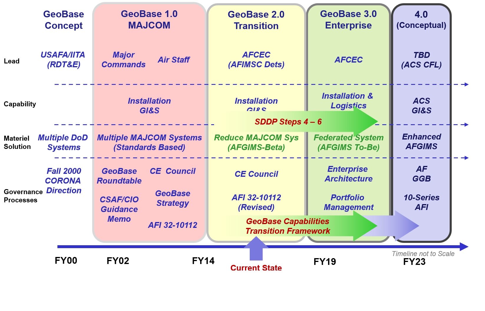
In 2001 the Air Force initiated the GeoBase Program with a vision of building and sustaining "One Installation, One Map", developing policy, guidance, and standards to align disparate technology implementations across the enterprise.
Mr. Feinberg served as the GeoBase Program Chief Architect at HQ Air Force on a multi-year basis, driving the development of enterprise architecture, standards, and policy to achieve the GeoBase program goals.
As a result, the Air Force to this day sustains the GeoBase program ensuring cost efficiencies, supporting numerous Air Force missions, and ensuring installation real property asset data are Visible, Accessible, Understandable, Trusted, and Interoperable.
Project Activities and Deliverables
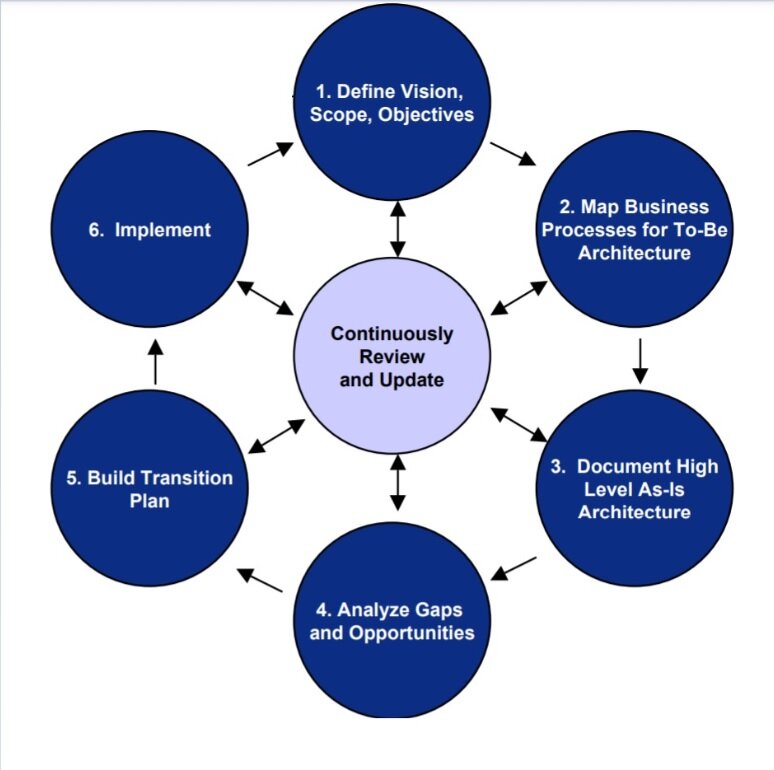
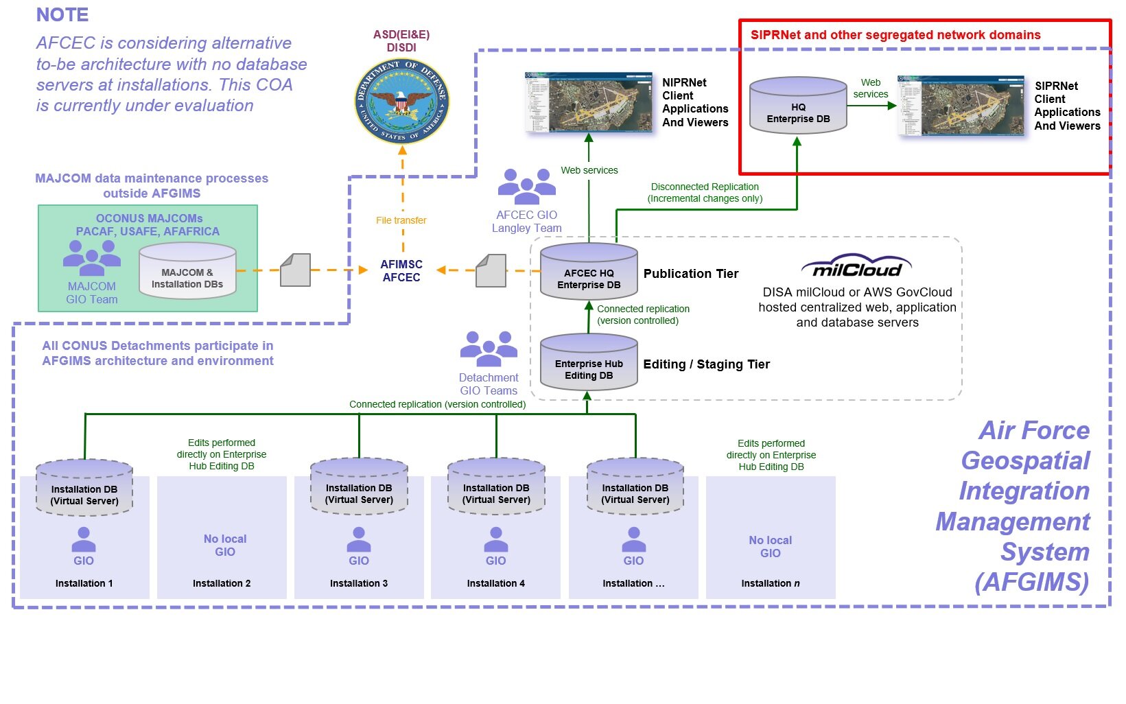
Produced an enterprise architecture baseline using the DODAF framework, presented the GeoBase Enterprise Architecture to the Air Force CIO for approval. The GeoBase Enterprise Architecture enables geographic information system (GIS), digital mapping, and location intelligence capabilities across all U.S. Air Force installations.
Developed the GeoBase Concept of Operations, Quality Assurance Plans (QAPs), standard operating procedures (SOPs), policy, data, and metadata standards.
Performed portfolio management and independent verification and validation (IV&V) services to review installation compliance with GeoBase standards. Performed program reviews at numerous installations to validate budget allocations, compliance with GeoBase architecture, policy, and standards, and interoperability with other Air Force systems.
Provided communication and outreach and coordination with other federal agencies including the Office of Management and Budget (OMB), Governmental Accountability Office (GAO), National Geospatial-Intelligence Agency (NGA), and the Federal Geographic Data Committee (FGDC).
Served in a similar role at the Office of the Secretary of Defense (OSD) as Chief Architect of the Defense Installation Spatial Data Infrastructure (DISDI) Program. The DISDI Program coordinates geospatial IT investments for real estate and asset management across the entire DOD and coordinates these investments with OMB and other Federal departments.


